Projecting Topographies: Imaging Sand as a Site of Violence and Resistance in Gaza
Mika Yassur
This piece maps Gaza’s topography as a site of military intervention and material resistance, examining the lineage of colonial vision and land intervention across scales and colonial regimes.
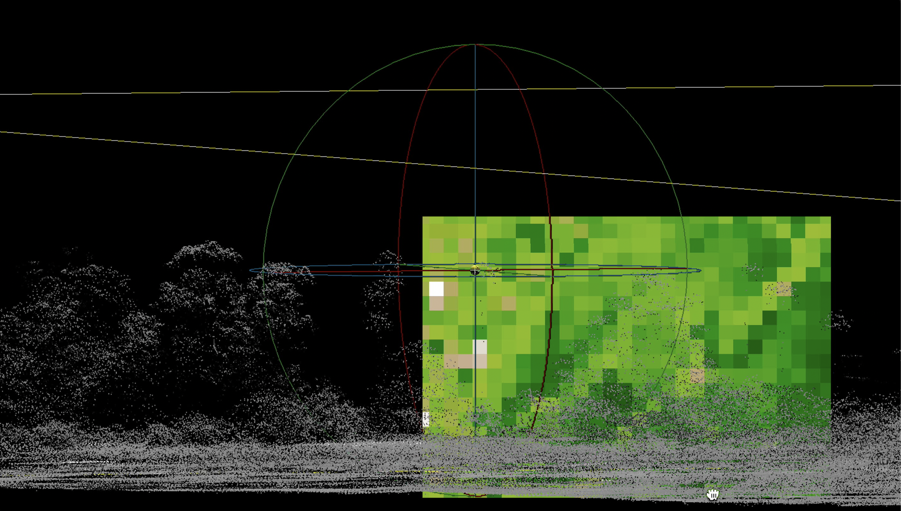
I argue that mechanisms of machine vision currently implemented in Gaza are grounded in cartographic methods of numerization—the gridding and codifying of space. The ways that these AI systems “see” into the world has a legacy in colonial cartography and satellite image processing developed for military use.[1] While the algorithms and functions that process these data seem immaterial, these mechanisms are built on and with topographical and geological foundations.
Understanding the material foundations for these technologies and perspectives highlights the role of the geologic in colonial sensing and vision—what scholar Kathryn Yusoff calls the “‘view from the plateau,’ the confident colonial gaze that seizes a geographic imagination of place as resource and field of conquest.”[2] In Palestine, the view from the plateau manifests as the view from the camera placed on top of the earth berm, from the settlements built on the hilltops of the West Bank, and from the top of Gaza’s sandstone ridges that are now dotted with Israeli military outposts. Yet it is not only the horizontal gaze that has a geological foundation, but the view from above as well; the view from the map and the satellite are projected and calibrated from a topographic and material ground.
The visualization of geologic ground through colonial mechanisms of seeing manifests in the reformation, partitioning, and classification of land. As I argue, these ways of seeing are passed down not only through technologies of land measurement and visualization but between colonial projects, from the British Mandate to the Israeli state.
Following this, Kathryn Yusoff asks, how do we desediment the power of the plateau? That is, how do we erode the topographic mound underneath the feet of the surveyor, or, like Fred Moten and Stefano Harney write, how do we end the standpoint from which colonialism makes sense?[3]
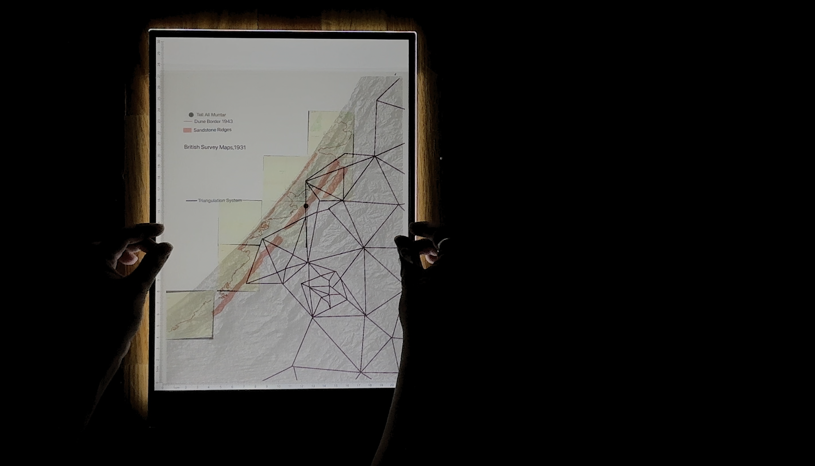
In this work, the desedimenting plateaus are the sand dunes that gather and sprawl along the Gaza coastline, blown up from the Sinai desert and deposited along the banks of the Wadi Gaza. Across the histories I trace, sand emerges as a resistant ecology and anti-foundation, a rift[4] in the colonial gaze.
From afforestation practices implemented during the British Mandate’s Sand Drift Ordinance[5] to Israeli colonization of the dunes between 1970 and 2005, sand is implicated in colonial taxonomies of “dead” land and mechanisms of expropriation despite Palestinian practices of dune cultivation and collective ownership. Simultaneously, sand resists these mechanisms in both representation and materiality, defying cartographic imperatives of fixity and colonial toxicity.
This work engages archival research, cartography, satellite image processing, analogue film, and desktop recordings to examine these modes of resistance and violence across scales. It renders visible the materiality of these processes through methods of collage and image treatment, taking the form of a video installation with live narration.
A version of this piece was accepted and performed at Spectres of the Undercommons: (In)humanities in the Wake of the Catastrophe at The American University of Cairo, organized by Extraterritorial Studio.
Anthony Downey. "Neocolonial Visions: Algorithmic Violence and Unmanned Aerial Systems." Aksioma, 2023. ↩︎
Kathryn Yusoff, Geologic Life: Inhuman Intimacies and the Geophysics of Race (Durham: Duke University Press) 2024, 108. ↩︎
Fred Moten and Stefano Harney, The Undercommons: Fugitive Planning & Black Study (Wivenhoe: Minor Compositions) 2013, 5. ↩︎
Yusoff, Geologic Life, 77. ↩︎
Dotan Halevy, “Stripped: Ruination, Liminality, and the Making of the Gaza Strip” (PhD diss., Columbia University) 2021. ↩︎